Areas Affected
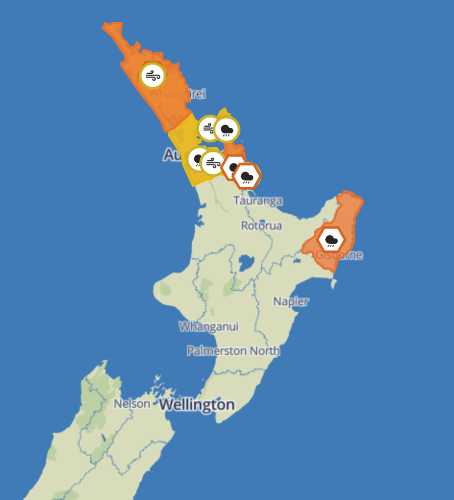
Northland
A
Heavy Rain Warning
is in place from
8am to 2pm
today. The region can expect an additional
40–70mm of rain
, with peak intensities of
20–30mm/h
and potential thunderstorms south of Bay of Islands. The MetService warns of rapidly rising streams and rivers, surface flooding, and slips. A
Strong Wind Watch
is also active until
11am
, with easterly winds potentially reaching severe gale in exposed areas.
Coromandel Peninsula
Rainfall between
80–110mm
is forecast from
8am Tuesday to 1am Wednesday
, with peak intensities of
15–25mm/h
. A
Strong Wind Watch
is also in effect until
3pm Tuesday
.
Gisborne/Tairāwhiti
The area will experience
80–100mm of rain
between
4pm Tuesday and 8am Wednesday
, with the heaviest downpours expected this evening and early Wednesday morning.
Auckland and Great Barrier Island
Periods of heavy rain are forecast from
8am to 5pm Tuesday
, with localized downpours and thunderstorms possible in northern and eastern parts. Easterly winds in exposed areas may approach severe gale.
Safety First
Residents in affected areas are urged to:
- Prepare by clearing drains and gutters.
- Avoid low-lying areas prone to flooding.
- Drive cautiously on wet and slippery roads.
The MetService reminds the public to stay informed as conditions may change throughout the day. Updates are expected by
9pm tonight
. Stay safe, New Zealand!