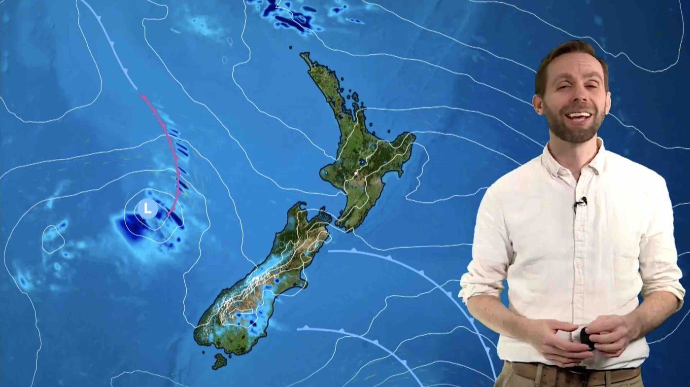
A complex and busy week of weather is taking shape across New Zealand, with a rapid succession of lows, fronts, and wind shifts arriving from Monday through to Friday. Conditions will differ markedly from one region to the next, and boaties should check local forecasts each morning. The most immediate concern is the potential for severe thunderstorms in the Far North overnight.
A front connected to a Tasman Sea low is tracking across the South Island today and pushing north into Tuesday. Close behind it, a second low approaches the North Island tomorrow, drawing in humid northerly airflows and several embedded fronts. A substantial low then crosses central New Zealand on Wednesday before moving off toward the Chathams. Relief arrives by Friday, when a ridge of high pressure builds and brings more settled conditions to most of the country.
Here is what all of this means for those heading out on the water.
*Severe weather risk, Northland*
A Severe Thunderstorm Watch is current from midnight through to 7am Tuesday, with northern and eastern parts of Northland north of Whangārei considered most at risk. Boaties should expect possible downpours of 25 to 40 millimetres per hour, with surface flooding, flash flooding, and slips all possible. Visibility will be poor in heavy rain, and squally winds may develop around storm cells. Anyone with vessels in the area should treat these overnight hours with caution and check for updated warnings on Tuesday morning before heading out.
*Upper North Island, unsettled, humid, and turning wet*
In the Bay of Islands, today brings north-westerly winds of around 20 knots easing to 15 before dropping to variable 5 knots overnight, with mostly fine conditions through the day. Tuesday sees light winds shifting north-east then north at 15 knots, showers developing with poor visibility, the possibility of thunderstorms, and a north-east swell of around 1 metre.
A very similar pattern applies across the area from Bream Head to Cape Colville, the Hauraki Gulf, and Waitematā Harbour. Today, westerlies ease to light conditions overnight under mostly fine skies, with a north-east swell generally running between 0.5 and 1 metre. On Tuesday, winds are light early before turning east at 15 knots and rising to north-east 20 knots through the afternoon, then easing again late in the day. Showers will develop from morning, visibility will drop in rain, and seas will build to moderate for a time during Tuesday afternoon.
*Coromandel and Bay of Plenty*
Today is fine with westerlies easing to variable 5 knots. Tuesday starts with light winds before a north-east to northerly 15 knots fills in. Showers develop from midday, seas remain slight, and the north-east to east swell holds around 1 metre.
*Central North Island Lakes, Rotorua and Taupō*
Both lakes see light winds and fine conditions today. Tuesday begins quietly with light winds, a north-easterly 10 knots arriving later in the day, and showers possible in the afternoon alongside the chance of thunderstorms. Visibility can drop quickly around any storm cells, so keep a close watch on developing conditions.
*Hawke Bay*
Today is fine, with easterlies easing before westerlies build late in the day. Tuesday brings westerly winds of 15 knots changing to north-east by midday and north-westerly by evening, with showers developing during the afternoon.
*Western North Island*
Kapiti has a relatively straightforward setup. Today sees north-westerly winds of 15 knots with slight seas and fine weather. Tuesday brings north-westerlies easing to variable in the afternoon, conditions becoming fine, and a westerly swell of around 1 metre.
Mana faces a considerably more energetic week. Today, northerly winds of 25 knots gusting to 35 ease to north-westerly 20 knots overnight, with a rough sea easing through the day. Tuesday brings north-westerly 20 knots gusting to 30, easing to north at 10 to 15 knots, with mainly fine conditions and a chance of a morning shower. Wednesday is north at 10 knots becoming southerly 15, rising to south-west 25 knots later in the day with rain easing. Thursday sees south-west 30 knots easing to southerly 20, with showers clearing. Friday turns from southerly 20 to northerly 20 early in the day under partly cloudy skies. Mana boaties are in for a highly changeable week and should plan accordingly.
*Wellington Harbour*
Today, northerly winds of 25 knots gusting to 35 ease through the evening. Tuesday brings north-westerly 20 gusting to 30, easing to northerly 15 before a southerly 10 arrives late in the day. Swell is nil significant for the South Coast and Palliser Bay, with an easterly swell of 1 metre for Castlepoint. Conditions ease on Tuesday afternoon but turn southerly again through Tuesday night.
*South Island*
In Christchurch, today brings an easterly of 15 knots easing with a chance of a shower. Tuesday starts with light winds turning north-east 15 before a south-westerly 15 arrives in the afternoon, with showers or rain developing later in the day and a north-east swell of 1 metre easing. Wednesday brings further showers as the large low crosses the country, with a settling ridge expected to arrive from late in the week.
*Outlook for the week*
Friday looks the most settled day nationwide as the high-pressure ridge builds. The toughest conditions fall across Northland overnight Monday into Tuesday with thunderstorms and heavy downpours, across Mana and Wellington today and through the middle of the week with repeated strong-wind episodes and direction shifts, and across the North Island's east coast and Gulf regions on Tuesday with showers, poor visibility, and rising north-east winds. Swell on the West Coast is elevated, reaching up to 3 metres early in the week, while elsewhere it remains generally modest.