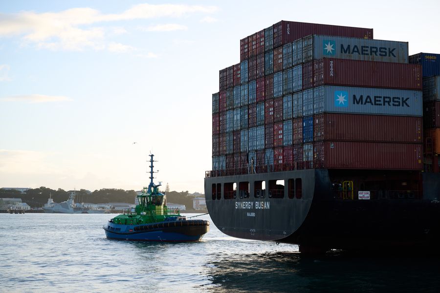
A broad trough draped across northern and central New Zealand is the dominant feature today, bringing rain, low cloud, and reduced visibility to a wide sweep of coastline. A ridge builds through tomorrow, offering gradual improvement, but mariners across exposed harbours and open coasts should expect unsettled conditions for now.
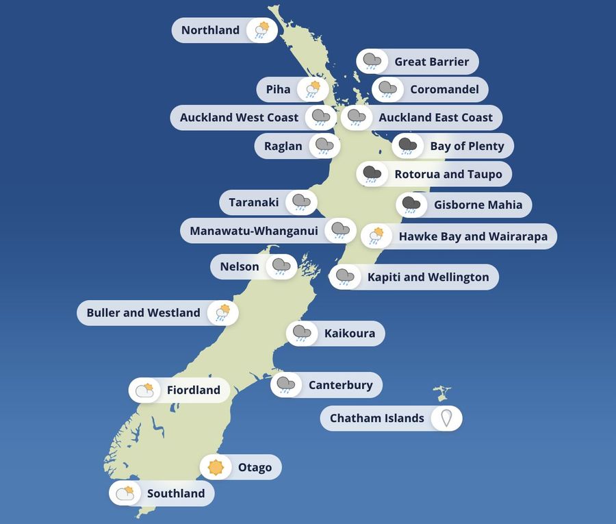
In the Waitematā Harbour, a northeasterly of around 20 knots with gusts to 30 is easing to 15 knots through the morning, then swinging northwest to about 10 knots this evening. Seas are moderate and easing, visibility is poor in rain, with showers developing later as conditions gradually improve.
The Manukau Harbour is seeing lighter winds, with a northeasterly of 10 knots turning northwest to around 10 knots this afternoon. Seas are slight, visibility is poor in rain, and a westerly swell of 1 metre is running on the west coast.
Further south, Wellington and the South Coast face a northerly rising to 20 knots this afternoon, with seas becoming moderate and occasional rain reducing visibility at times. At Castlepoint, a northeasterly swell of 2 metres is running.
In Christchurch, a northeasterly of 20 knots is easing to variable 5 knots through the morning, with an easterly of around 15 knots developing in the afternoon. Seas are easing and visibility is fair in patchy rain, clearing later in the day.
The Coromandel coastal waters carry a Strong Wind Advisory today. Northerly winds of 25 knots with gusts to 35 are easing to 15 knots this morning and turning northwest to around 10 knots this afternoon. A northeasterly swell of 2 metres is easing, though visibility remains poor in rain, transitioning to showers as the day progresses.
The broader picture is driven by a humid northeasterly flow and a weakening frontal system delivering widespread heavy rain across much of the upper North Island today and into Wednesday. The front loses intensity overnight, though not before producing significant rainfall totals across several regions. A ridge then builds through Thursday and Friday, bringing a return to more settled conditions.
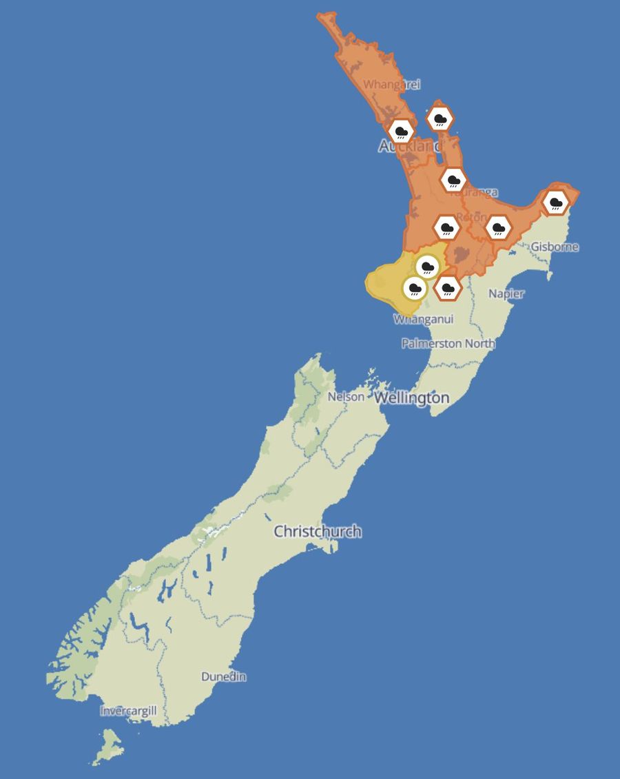
Heavy Rain Warnings at the Orange level are in place across a number of areas. For Northland, Auckland, and Great Barrier Island, the warning runs from midnight Tuesday through to 2pm Wednesday, with 80 to 100 millimetres expected and isolated downpours capable of 25 to 40 millimetres per hour. There is a low chance of an upgrade, with rapid river rises, slips, and surface flooding the key concerns.
The Coromandel Peninsula is in for the heaviest totals, with 120 to 150 millimetres forecast between 8pm Tuesday and 3pm Wednesday, the worst of it on higher ground. Downpours of 25 to 40 millimetres per hour are possible, with flooding and slips likely on coastal roads.
For Waitomo, Waikato, and Taupō, the warning period runs from 10pm Tuesday to 6pm Wednesday, with 70 to 110 millimetres expected, heaviest in the east. Rivers will respond quickly and morning travel disruption is likely. The Bay of Plenty faces a longer window, from 10pm Tuesday through to 11pm Wednesday, with 140 to 180 millimetres forecast, the bulk of it west of Whakatāne. Slip risk is high and rapid stream and river rises are anticipated.
Gisborne north of Ruatoria is under a warning from 6am to midnight Wednesday, with 100 to 120 millimetres expected and peak rainfall rates of 25 to 40 millimetres per hour likely through late morning and into the afternoon. Tongariro National Park carries a warning from 1am to 10pm Wednesday, with 100 to 140 millimetres and intense downpours possible.
Heavy Rain Watches remain in place for Taumarunui and Taihape, where there is a moderate chance of an upgrade to a warning, and for Taranaki, where heavy rain is possible but considered less likely to reach warning criteria.
A ridge settles across most of the North Island on Thursday, easing conditions. A weak front brushes the upper South Island and Westland on Friday and Saturday. By Sunday, a strong ridge spans both islands, though a weak trough may linger near the Far North.