A powerful front tracking eastward across New Zealand is set to deliver significant rainfall and strong north to northeasterly winds across much of the country from late Monday through to early Wednesday. MetService has issued a series of Orange Warnings and Watches, and authorities are urging people to make preparations ahead of what could be a hazardous period of weather.
The Bay of Plenty faces the heaviest anticipated totals in the North Island, with up to 180mm of rain forecast between Tuesday morning and early Wednesday. There is a moderate chance that the warning for this area could be upgraded to a Red Warning should conditions deteriorate further. Heavy Rain Warnings are also in place for the Coromandel Peninsula, Taranaki Maunga, and the Central North Island ranges, where localised downpours and thunder remain possible.
Northland and Auckland are covered by heavy rain Watches, with the most intense falls expected to peak during the late Tuesday morning period. Wind Watches are active across both regions, with northeast gales potentially reaching severe strength in exposed locations. Inland districts, including Waikato, Waitomo, Taupō, and Taumarunui, may experience prolonged heavy rain that approaches warning thresholds over the same period.
[embed]https://images.boatingnz.online/wp-content/uploads/2025/07/28133931/MetService-Weather-Video-28072025.mp4[/embed]
Sustained rainfall across the upper and central North Island raises the likelihood of elevated river levels, surface flooding, and an increased risk of slips. Road conditions are expected to become difficult in places, and drivers are urged to take particular care on rural and hilly routes throughout the affected area.
On the South Island, the most significant rainfall is forecast for Tasman, Marlborough, Westland, Otago, and Canterbury, concentrated especially over the ranges. Areas east and south of Motueka are under close scrutiny, with a high chance that a Red Warning will be issued for that district. The Richmond, Gordon, and Bryant Ranges could receive up to 130mm, with potential consequences including flooding, road closures, and power outages. The Westland ranges and the headwaters feeding the Canterbury and Otago lakes and rivers are forecast to receive up to 180mm, with rainfall intensities peaking at between 20 and 30 mm/h at times. River crossings and alpine passes in these areas may become particularly hazardous, and residents across affected zones are advised to clear drains, monitor updated forecasts, and plan for possible disruption to transport and communication links.
Large northeast swells of up to 4.5 metres are forecast for the east coast of the upper North Island. The most powerful seas are expected from Tuesday morning into the evening, with coastal roads, low-lying settlements, and beach access points potentially affected by wave run-up and erosion.
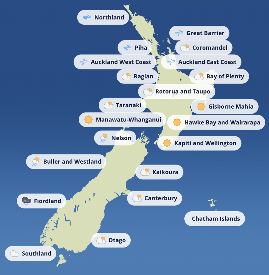
Overnight temperatures across the North Island are expected to remain notably mild with this system. Whakatāne is forecast to drop no lower than 13°C, just two degrees below its daytime high from the preceding Sunday.
From Thursday, the main system is expected to clear offshore and conditions should ease across most of the country. A deep low developing to the east may direct strong southerlies onto the eastern North Island, while a separate low is tracking past the far north. The risk of further severe weather at this stage appears minimal, though MetService is advising everyone to continue checking updated forecasts as the situation develops through the week.