A powerful winter high is sitting squarely over New Zealand this week, covering Monday 21 to Friday 25 July, and with it comes the kind of settled, frosty weather many boaties have been waiting for after a run of wet, miserable conditions. Cold nights, crisp blue days, and light winds are the dominant theme, but that picture is not uniform across every coastal zone, and a few areas deserve real caution.
For those keen to get on the water, the upper South Island and much of the central North Island are the clear standouts. Conditions through those regions are shaping up for comfortable cruising, fishing runs, or even just getting through a long list of boat maintenance. The Raglan, Abel, and Stephens coastal zones look particularly benign through to Thursday, with variable winds and offshore swells that remain gentle to moderate, well within reach for small craft and anyone keen on a bit of winter exploring.
The Kaipara and Colville areas are also worth considering for midweek trips. Wednesday and Thursday in particular look promising as easterlies ease and swells stabilise in the 1 to 2 metre range. Out on the Hauraki Gulf, glassy mornings are on offer for much of the week, though trailer boaters launching from inland ramps should stay alert to patchy frost and the possibility of fog reducing visibility before the sun gets going.
Not every corner of the country is so cooperative, however. Several areas warrant genuine caution before any plans are locked in.
The eastern North Island, covering Tairāwhiti Gisborne and Hawke's Bay, will be sitting under cloud and catching occasional showers until Wednesday night, held there by a lingering southeasterly flow. Coastal winds will be gusty at times and visibility reduced, making those waters far from ideal for anything offshore until conditions improve later in the week.
Down south, Fiordland starts the week quietly enough but takes a sharp turn for the worse from Thursday as a front pushes in from the Tasman. The Milford, Puysegur, and Foveaux zones will see northerlies building through Thursday, with seas turning rough to very rough by Friday and swells rising rapidly. Anyone planning passages in that region needs a clear exit strategy before Thursday arrives.
The Chatham Islands are best left alone this week. Stiff southerlies and rough seas persist through most of the period, with winds around 25 knots and a southeast swell reaching up to 3 metres through Wednesday. Even by Friday, any easing is only marginal.
Fog is another hazard worth flagging, particularly for trailer boaters launching near the inland valleys of Otago, Southland, and the Mackenzie Basin. Twizel is forecast to drop to -5°C at midweek, Christchurch has already recorded its coldest July temperature this year at -3.8°C, and inland Dunedin and Taumarunui are not far behind. Slick ramps and low-visibility mornings are a real risk across these areas.
Wednesday 23 July is the day to circle on the calendar. High pressure is fully established, shower activity in the east has eased, and light winds extend from the Bay of Plenty through to Nelson, Kaikōura, and across the inland lakes. For most regions it is the week's best window, and the day to prioritise if work and weather align.
Friday brings a change. The Tasman front begins making landfall, and Fiordland, the West Coast, and southern offshore zones will feel it first, with increasing cloud, northerlies gusting to 35 knots around Puysegur, and rising swell. By Friday afternoon, conditions in those areas will be marginal at best, and bar crossings or longer offshore passages should be planned with considerable care.
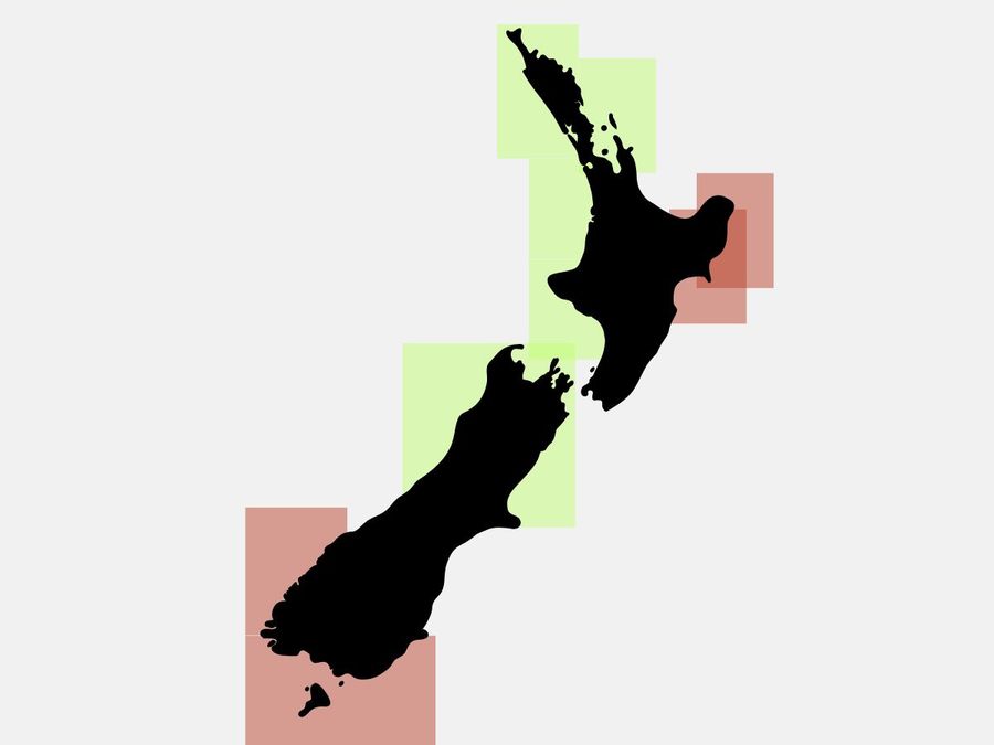
The top spots for the week are Abel, Raglan, Colville, the upper West Coast, and the central North Island lakes. The areas to avoid are the eastern North Island until Thursday, Fiordland and Puysegur from Thursday onwards, and the Chatham Islands throughout the entire period. Freezing decks, slippery ramps, and inland fog are worth keeping in mind all week, particularly for early starts.