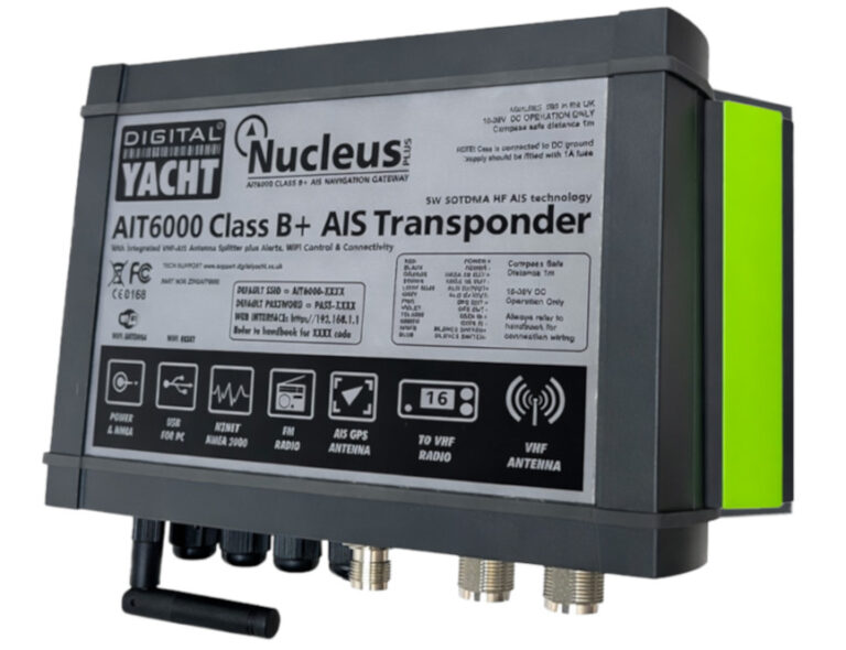
For recreational boaties who already regard AIS as standard equipment, Digital Yacht's AIT6000 represents a meaningful step beyond what most have used before.
Sold under the name Nucleus, the AIT6000 sits at the top of the recreational AIS hierarchy as a Class B+ transponder. Its transmission method is SOTDMA, the same technology that powers commercial Class A systems. Rather than queuing behind commercial traffic waiting for a spare slot, the unit competes for transmission time on equal terms with commercial shipping. Combined with a 5W output, the result is a better range than conventional Class B units can offer.
The feature that most clearly separates the AIT6000 from its competitors is SPAIS, Digital Yacht's own satellite AIS technology. When SPAIS is switched on, it optimises the unit's transmissions so they can be picked up by AIS satellites overhead. Land-based AIS stations lose contact beyond 20 nautical miles from shore, but SPAIS means a vessel's position continues to be visible to rescue authorities and tracking services well past that point. For a crew crossing the Tasman, remaining trackable from mid-ocean could matter a great deal.
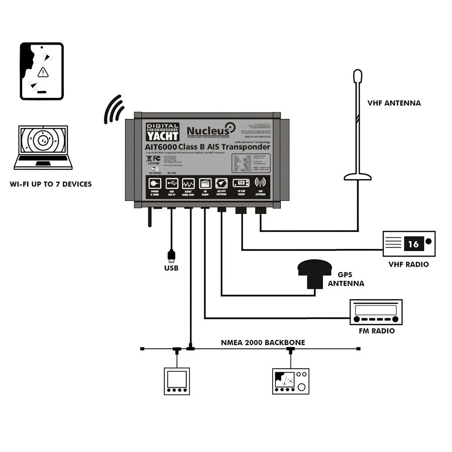
Antenna management has been handled thoughtfully. A zero-loss integrated VHF antenna splitter lets a single main VHF antenna carry AIS, VHF radio and FM/DAB signals simultaneously, with no degradation to any of them. The AIT6000's own GPS receiver uses a dedicated antenna supplied on a 10m cable, kept entirely separate from the VHF side.
The Nucleus name hints at the unit's role as a central hub, and the connectivity options bear that out. Legacy chart plotters are supported via NMEA 0183, while modern navigation networks connect through NMEA 2000. USB covers PC and Mac connections. A password-protected onboard Wi-Fi network serves up to seven devices simultaneously, distributing AIS targets, GPS position and full NMEA 2000 instrument data including depth, heading, speed and wind to any connected phone, tablet or laptop. Navigation apps including Navionics, TZ iBoat, Savvy Navvy and OpenCPN connect to that network without any additional configuration. The Wi-Fi link is bidirectional, so data flowing in from navigation apps can also be pushed back out to other onboard equipment, autopilot included.
Collision alarms for CPA and TCPA operate independently of any chart plotter, meaning watchkeepers receive warnings without needing a screen powered up and running. CPA, Closest Point of Approach, calculates the minimum distance at which an approaching vessel will pass given its current speed and heading. TCPA, Time to Closest Point of Approach, indicates how many minutes remain before that closest point is reached. Used together, these figures give a clear picture of developing risk without having to interpret a cluttered plotter display. An anchor watch alarm calculates drift radius from depth and chain scope. All of it is configured through a browser-based web interface, with no software installation or dedicated app required.
To access the settings, connect any device to the AIT6000's Wi-Fi network and open a browser. MMSI programming, Wi-Fi configuration, alarm thresholds, AIS silencing and diagnostic monitoring are all managed from within that browser interface, with nothing to install and no separate app required.