Vaianu moves on, leaving significant damage in its wake
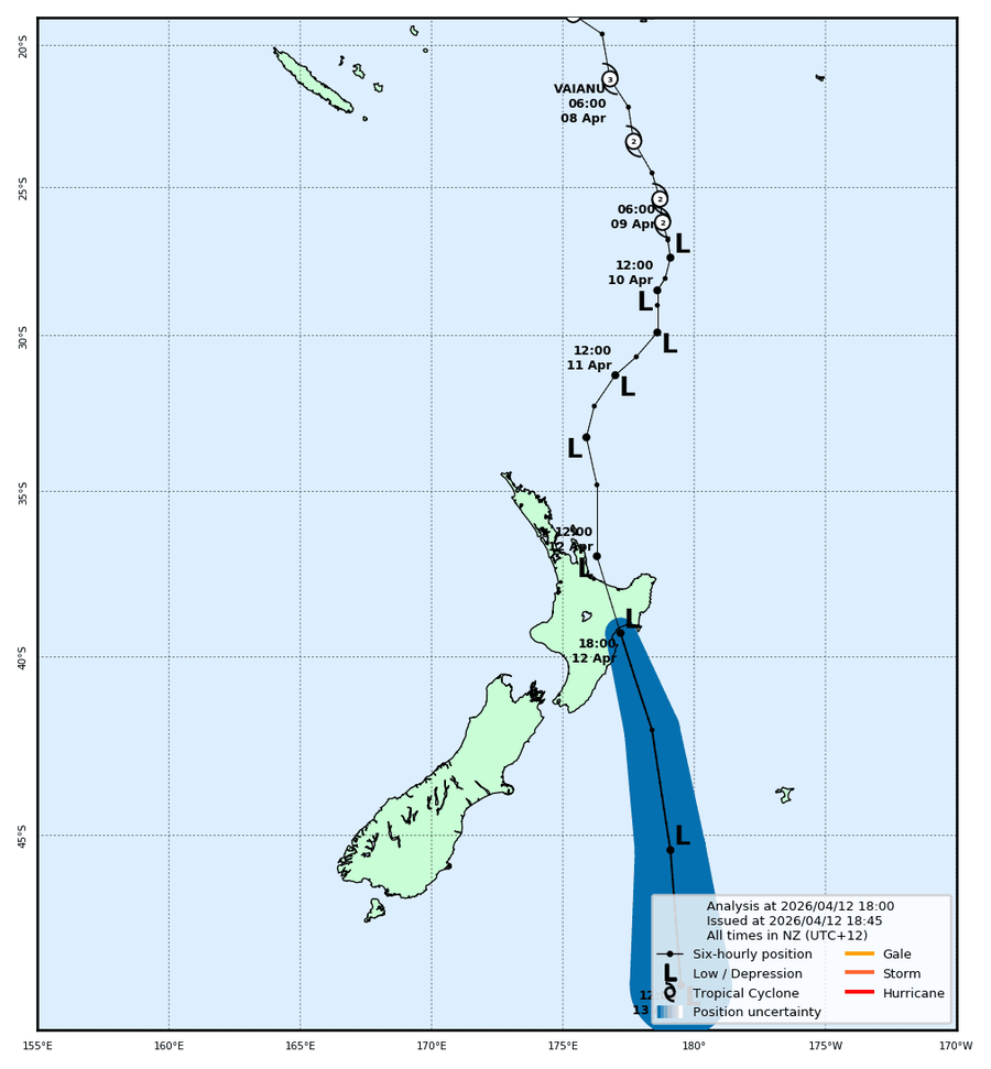
Cyclone Vaianu has tracked across the northern North Island and is now moving away to the southeast, expected to pass the Chatham Islands on Monday morning. The day's most severe impacts fell on the Coromandel Peninsula and Bay of Plenty, where Red Warnings remained in force through the afternoon, thousands of homes lost power, and communities including Whitianga, Ohope and Whakatane were cut off or evacuated. Whakatane took a particularly hard hit, with roofs lifted, trees uprooted, and around 270 households in Ohope and Thornton had been evacuated ahead of the storm as a precaution.
Seas remain dangerous after dark
For boaties, conditions remain serious well into tonight. The worst seas are now south and east of the cyclone's track, with a Storm Warning on Hawke Bay where northeast winds reached 50 knots gusting to 65, and northeast swell building to 7 metres in the Portland zone off the East Cape coast. A Heavy Swell Warning remains in force for the Wairarapa coast until 3am Monday, with combined waves of up to 6 metres expected to peak around the midnight high tide at Cape Palliser. Cook Strait is building through the evening as the system moves through. The Hauraki Gulf and Waitemata are easing, but both were still running westerly 30 to 35 knots gusting to 50 as of the 4:30pm forecasts, with northeast swell of 2.5 metres in the Gulf.
Chris Newman, who has been at Great Mercury all day on his boat, has been providing updates as the day goes on, his final update is below: [video width="576" height="1024" mp4="https://www.boatingnz.co.nz/wp-content/uploads/2026/04/70b164ca-d551-4630-9183-6cc10c8fee37.mp4"][/video]
Monday: better, but not done yet
Conditions should be manageable across the north by Monday morning, though an unstable westerly flow moves in during the day bringing the risk of thunderstorms through the afternoon and evening. Swell takes time to subside after winds ease, and gale warnings remain in place for Colville Channel, Bay of Plenty offshore and Castlepoint into Monday. Anyone planning to get back on the water should check the latest MetService forecasts carefully before heading out. The week ahead looks unsettled, with a series of fronts crossing from the west Tuesday through Friday and further heavy rain and thunderstorm risk on Tuesday in particular.
The windsurfer who wasted everyone's time
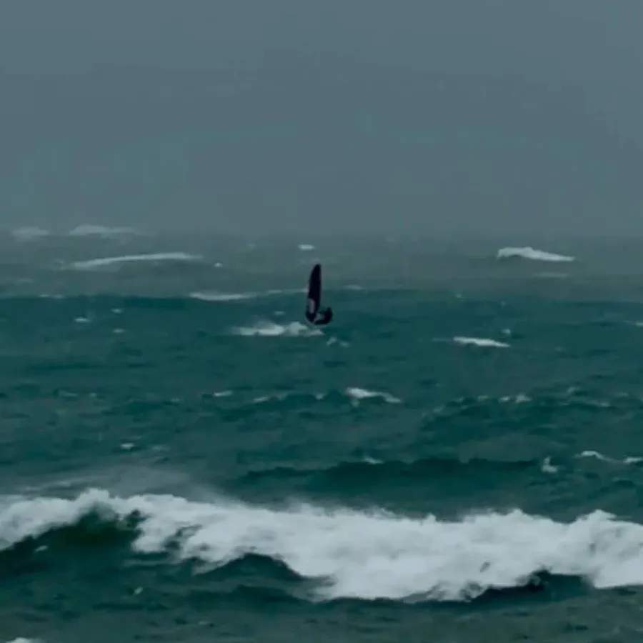
The Napier Coastguard had a timely reminder for anyone tempted to make the most of the conditions: a windsurfer spotted in rough seas near Napier Port during the state of emergency tied up two police cars and nearly triggered a rescue operation. Coastguard told him plainly he had wasted precious resources.
This article is written by
Boating New Zealand
with inputs from MetService and RNZ.co.nz