Wellington Civil Defence has called on south coast residents to leave their homes on Monday night, ahead of a mandatory evacuation order taking effect at 9am Tuesday. The order follows Wellington City mayor Andrew Little's declaration of a State of Emergency for the city's Southern and Eastern wards, with authorities warning that a powerful southerly swell system is bearing down on the Cook Strait region.
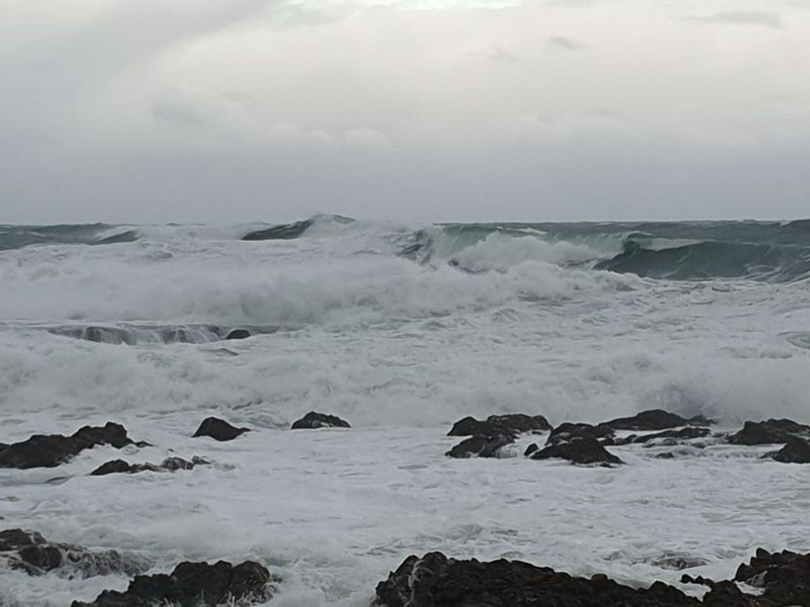
MetService has issued a Heavy Swell Warning from Cape Terawhiti to Turakirae Head in Wellington, and from Turakirae Head to Mataikona in the Wairarapa. Combined wave heights of 9.5 to 10.5 metres are forecast through Cook Strait from Monday evening until Wednesday morning, with a peak wave period of 13 to 15 seconds. Conditions are not expected to ease until midday Wednesday.
The mandatory evacuation covers waterfront properties in Owhiro Bay, Island Bay, Houghton Bay and Breaker Bay. Lyall Bay is not included. An emergency alert issued at 6.30pm stated plainly: "You will be required to leave by 9am tomorrow. After this time, it may be too dangerous to leave your property. Do not return until told it is safe to do so."
Wellington City Council reinforced that message, advising south coast waterfront residents and anyone concerned about flooding to secure alternative accommodation on Monday night. The council confirmed that extensive road closures are expected across the south coast throughout Tuesday 9 June, and that all people in affected areas, including their pets, must be clear of their properties by 9am at the latest. For those without alternative arrangements, an Emergency Assistance Centre has been opened at Wellington South Baptist Church, 284 The Parade, from 9pm Monday 8 June.
Wellington Civil Defence spokesperson Dan Neely urged the public to stay well back from the water and to avoid beaches and coastal areas entirely, even where conditions might look calm. To put the expected swells in perspective, he drew a comparison with a previous event.
"In 2020 a heavy swell event struck Wellington's south coast with 5.5-metre waves pounding coastal suburbs, causing widespread damage and evacuations. Tomorrow, we expect the swells could be up to 8m around Wellington's south coast, so we are preparing for a significant swell event and asking the public to do the same."
Neely also cautioned that surface flooding and debris on roads posed genuine risks, particularly around the midday high tide. "The sun might be shining but these swells could bring debris and surface flooding to roads, especially around high tide at midday. The public is urged to avoid Wellington's south coast roads, as well as coastal roads around Wairarapa. Extreme caution should be taken if you have to drive on these roads."
Speaking to Checkpoint, Neely identified the window between 10am and 1pm Tuesday as the period of greatest danger, given its overlap with high tides. "The key message is to stay away from the coast for residents along those vulnerable south coast communities that are concerned about flooding. We're really encouraging people to leave their homes tonight, go somewhere else." He added that anyone whose property had been caught up in earlier swell events should not wait until morning to act.
Emergency services, councils and partner agencies are coordinating their response. Civil Defence has issued the following guidance to people in affected areas:
- If your home has been impacted by past swell and storm events or are in exposed coastlines prepare to self evacuate. - If you cannot arrange accommodation, call your local council for assistance. - If you are planning to say, prepare a grab bag with supplies relevant to your family in case you have to leave with short notice. - People living close to swell and surf exposed coastlines should be prepared for the possibility of waves flooding roads and leaving debris, with potential for road closures, and potential damage to property. - Move important items out of harm's way, particularly if they are in low-lying garages. Bring pets inside. - Check on neighbours who might need some support.
Have you been affected? Share your stories and pictures with us at:
ahoy@boatingnz.co.nz
MetService meteorologist Lewis Ferris said the system would affect Wellington's south coast, the Wairarapa coast and parts of the South Island's eastern coastline. The combination of significant wave height and long period would give the swells considerable energy, increasing their tendency to surge up beaches and into coastal areas. "Tomorrow won't be a good day to go out on any sort of southern coastlines, especially around Wellington. Don't take the dog for a walk; don't go just to see the large waves roll in," he said.
Ferris emphasised that residents should follow local authority guidance and keep away from the coast, noting that emergency personnel would need clear access to coastal areas for sandbagging and other protective work. The most severe swell activity is expected to coincide with high tide around midday and into early afternoon on Tuesday. Strong wind watches have also been issued for parts of the lower North Island and the Otago coast.
Cook Strait ferry services have been significantly disrupted by the forecast. Bluebridge cancelled its 8.30pm Wellington to Picton sailing on Monday, along with three Tuesday morning departures. Interislander cancelled all of its Tuesday sailings. Both companies said they were contacting affected customers and moving them onto the next available services.
| This story was first published on rnz.co.nz |  |